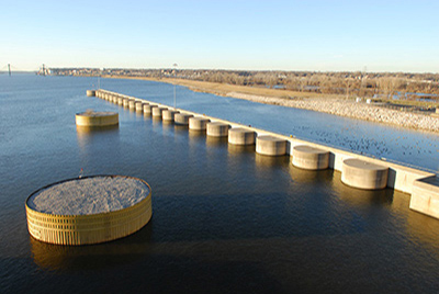
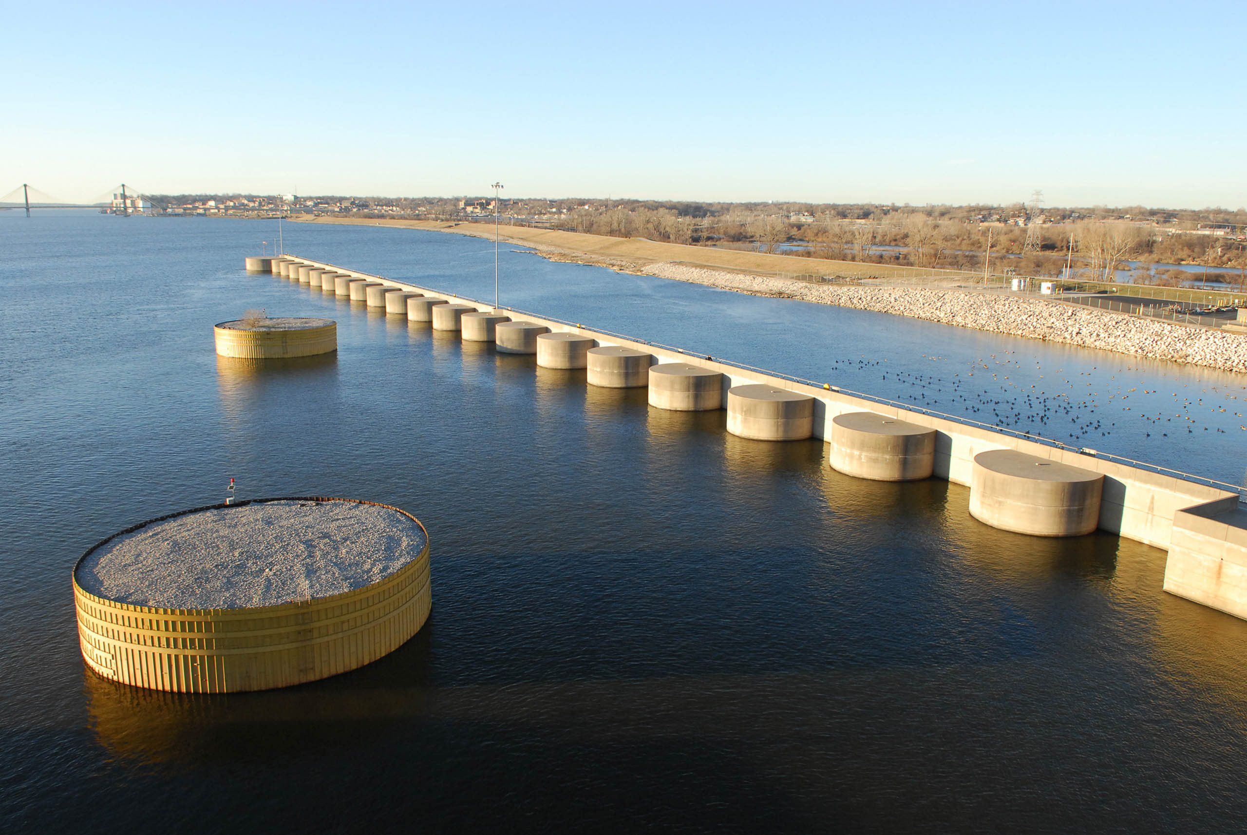
Passing through flood-gates in the levee, you enter Lock and Dam Way, which leads to three regional riverside destinations: The Melvin Price Lock and Dam, the National Great Rivers Museum, and the Great Rivers Interpretive center. Here, visitors can learn about the geology, history, and cultures of the broader confluence region—where the Illinois and Missouri rivers join the Mississippi. Significantly, here is where one can learn more about the 9-foot channel project—the Congressional mandate that gives rise to so many of the large infrastructural projects that define the Mississippi River and its tributaries. Construction of the current dam—Lock and Dam #26R—was completed in 1994 and was built as a replacement for an earlier lock and dam system whose size was no longer sufficient for the scale of updated barge traffic and whose structural integrity was undermined by a number of geological and construction related factors. This new construction marked the first removal of a dam complex associated with the original 1920s era 9-foot channel infrastructure. The original Dam #26 was constructed at river mile 202.9 under a WPA effort from 1934-1938. 110’ wide and 600’ long—but was almost immediately plagued by a series of hydraulic and structural problems. Of the notable issues that precipitated its decommissioning and the construction of the new Lock #26 was significant scour holes that formed below the dam and threatened to undermine piles supporting the dam. The original complex spanned the river from downtown Alton across to Ellis Island (neé Smallpox Island). The new and current dam location is at river mile 200.78—approximately two miles downstream from the original complex. Construction began in 1979 and was significantly completely by 1992. The new lock is 110’ wide by 1,200’ long—twice that of the original lock system. The Historic American Engineering survey describes the main lock as a “U-shaped megastructure”, with walls extending 61’ from the floor—which is itself a 20’ thick concrete slab. The lock complex is connected to the Missouri shore with a 1,160 foot-long movable dam—allowing the complex to manage the elevation of the pool above the dam, having affects not only on Lock and Dam #25, but also on the Illinois River itself. Flow on this low-gradient tributary to the Mississippi is often slowed by what river engineers call a hydraulic-dam—an impoundment resulting from the back-pressure of high-water in the receiving water body. Construction of the complex was authorized by congress in 1974, but significant challenges by the Sierra Club, Izaak Walton League, and the Western Railroads Association contributed to its delayed construction. While less known than their conservationist peers, the Izaak Walton League in fact had a long history advocating for environmental imperatives in the already-highly managed river system. In 1931, and in response to the growing support for the 9’ navigation channel plan, the League tendered the first meaningful challenge to the vision of the Mississippi River as a purely navigational. This challenge marked the first meaningful conservationist argument against the longstanding vision of the river as handmaiden of industry.